
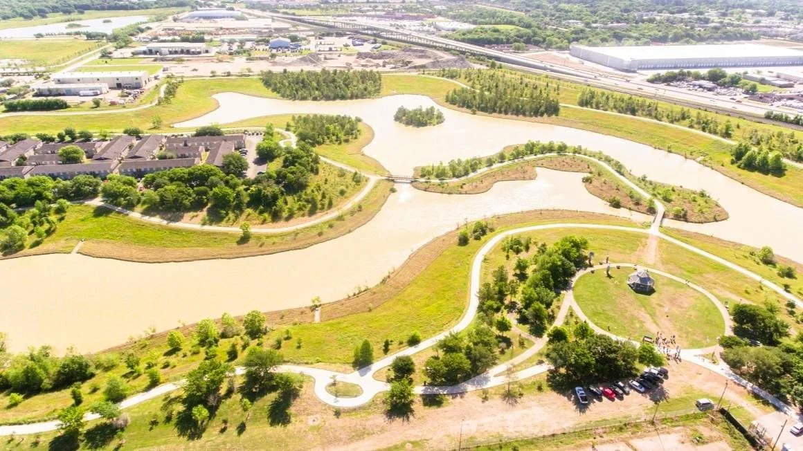
Lakes & Trails

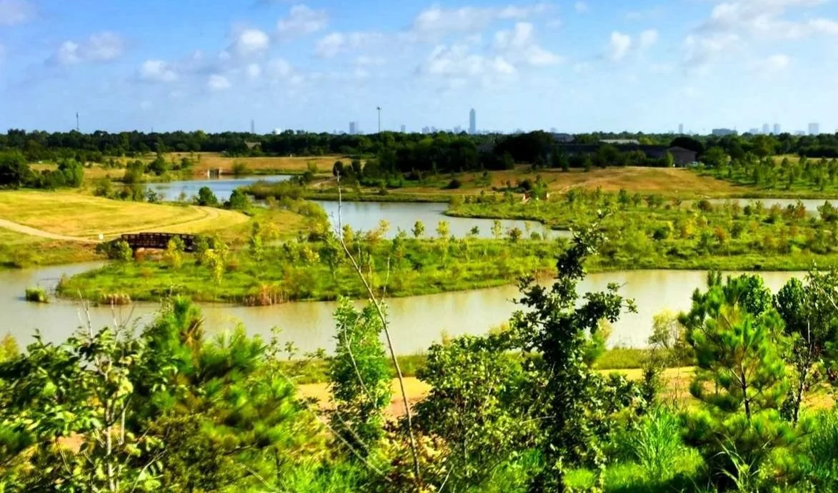
Explore six interconnected lakes and the trails, gardens, and wildlife habitats that surround them. With over 8 miles of accessible walking paths, wayfinding signage, and dozens of amenities, Willow Waterhole offers an outdoor experience unlike any other in Houston. Designed to manage stormwater while supporting native ecosystems, the park invites visitors to move through a landscape that blends conservation, recreation, and discovery.
Explore the Lakes
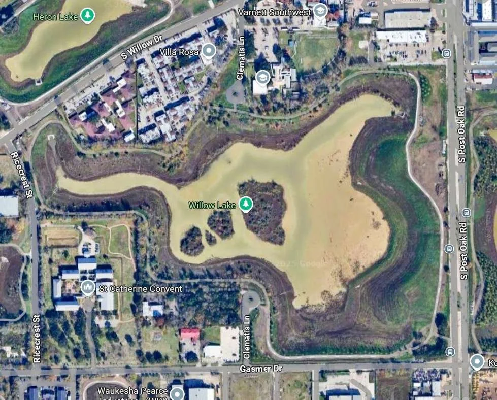
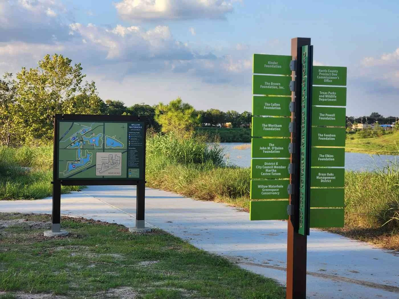
Willow Waterhole Map – Lakes, Trails, and Amenities

A. Westbury Lake
🌿Loop Trail: Kevin Shanley Trail (2.2 miles)
Overview
Westbury Lake is the largest and most visited part of the Greenway, named for the nearby neighborhood it serves. It functions as the park’s central gathering space, with loop trails, shaded seating, butterfly sculptures, a gazebo, and a fishing pier along the shoreline. Whether you're walking, resting, or taking in the view, Westbury Lake brings together many of the Greenway’s most loved features in one place.
Highlights & Features
Bob Schwartz Gazebo and central event lawn
Flagpoles and raised walkway at the main entrance
Scenic overlook with ADA compliant fishing pier
Trails: Karankawa, Akokisa, Ellis Island, Karen Cullar, Pier, West Airport
Naturescape wood sculptures
“Flowers for a Lady” butterfly sculptures
Elevated Overlook trail with views across the lakes and skyline
Capital Campaign recognition plaque
Picnic tables and benches
Central hub for community events and programs

Location and Parking
📍 The official entrance to the park from Dryad Drive to the west, Gasmer Dr to the north, and Hwy 90 to the south, this lake is at the heart of the park and connects directly to the central parking area and Bob Schwartz Gazebo.
Visit Directions page
🅿️ Main parking is located at 5300 Dryad Drive, with additional street parking nearby on Ricecrest. Trails lead to the gazebo and lakefront features.
Spotlight Features

Willow Waterhole Bridges
These iconic bridges span the lake’s inlets and connect the east and west sides of the loop trail. With their distinctive look and mirrored reflections, they’ve become iconic photo spots and are some of the most recognizable features of the Park.

Bob Schwartz Gazebo & Flag Plaza
A defining feature of the park, this covered gathering space sits along the lake’s western edge. It’s used for everyday shade, performances, and ceremonies, and remains one of the most photographed spots at Willow Waterhole.

“Flowers for a Lady” - Butterfly Sculptures
Three butterfly sculptures by Rosalinda R. Toro honor Kathleen Tinsley Ownby for her leadership in expanding park access and education in Houston. The artwork celebrates growth, beauty, and transformation.
Trail Overlook
Along the south side of the lake, this two-tiered trail offers elevated views across the water and far into the surrounding landscape. It’s one of Houston’s few natural overlooks and a peaceful place to take it all in.

Naturescapes: Wood Sculptures
Located near the gazebo, these carvings by James D. Phillips depict birds, fish, turtles, wildflowers, people, and even Buster the Dog. Each piece rests on a permeable base (installed by an Eagle Scout) and brings wildlife and community stories to life.

Fishing Pier - ADA Compliant
Extending slightly into the lake, this pier gives visitors a steady place to cast a line, watch the water, or take a quiet break. It’s a relaxed spot for casual fishing and enjoying the view.
B. Triangle Lake
🌿Loop Trail: Brown Foundation Trail (.9 miles)
Overview
Triangle Lake, named for the shape formed by its surrounding roads, is a welcoming entry point into the park and a favorite for birders and plant lovers. Trails lead past native prairie gardens, an ancient live oak, and one of the park’s most photographed spots—the Willow Waterhole sign. Nearby access to the Arboretum Trail and Birding Center makes Triangle a great place to start exploring both wildlife and the natural rhythms of the Greenway.
Highlights & Features
Willow Waterhole sign marks entry to the park
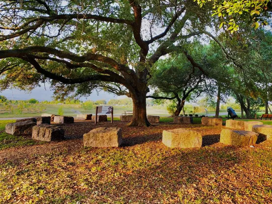
Outdoor classroom under ancient oak with stone circle seating
Kennedy Scout Pavilion recognizes scout contributions and provides shaded space for rest and gatherings
Jack Rafferty Memorial honors a dedicated HCFCD engineer and leader
Prairie garden and wildflowers
Arboretum Trail with native Texas plants and signage
Birding Center hosts monthly Audubon bird counts
Concrete culvert connects to Scout and Willow Lakes to balance water during storms.

Location and Parking
📍 Surrounded by Gasmer Drive to the north, South Willow Drive to the west, and Ricecrest Street to the east. Visit Directions page
🅿️ Street parking is available along Ricecrest Street, between South Willow and Gasmer. A paved trail leads directly to Triangle Lake’s loop trail and amenities.
Spotlight Features

Outdoor Classroom
This space includes circular stone seating for group instruction, nature talks, and student-led programs. It’s a popular location for school field trips, scout meetings, and environmental education.

Willow Waterhole Sign
This large Willow Waterhole sign near Triangle Lake has become a recognizable landmark and photo spot for park visitors. It anchors the lake’s northwest entrance and signals arrival into the park from South Willow Drive.
Jack Rafferty Memorial
This memorial honors Jack Rafferty, the Harris County Flood Control engineer whose 1940s master plan laid the groundwork for building detention basins like Willow Waterhole. It recognizes his lasting impact on flood control and the Westbury community.

Dabney Kennedy Scout Pavilion
This pavilion honors over 80 Eagle and Gold Award Scouts who completed projects at the Greenway. Named for Dabney Kennedy’s leadership and scouting career, it marks a meaningful point along the Triangle Lake trail.
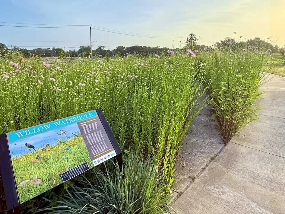
Native Plant Garden
Located near the pavilion, this vibrant prairie garden showcases seasonal wildflowers and grasses. Designed to reflect Houston’s native ecosystems, it supports pollinators and adds color and texture to the lakeside trail.
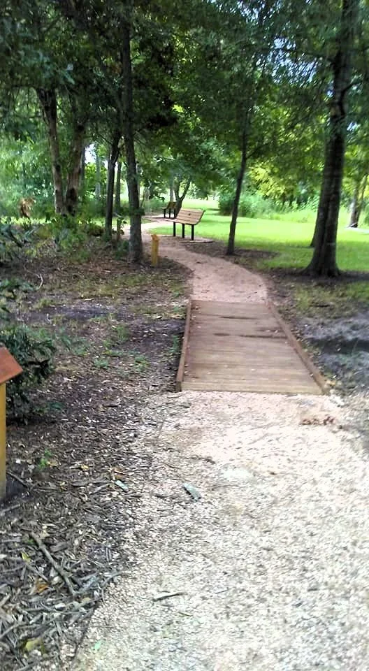
Arboretum Trail
A path through native Texas plants, this trail features interpretive signs and showcases local biodiversity. Built through Scout-led projects, it adds an educational layer to the Triangle Lake experience.
C. Scout Lake
🌿Loop Trail: John M. O’Quinn Foundation Trail (.4 miles)
Overview
Scout Lake may be the smallest of the six, but it plays a meaningful role in the park’s design. Its name honors the many scout-led projects that have helped shape the Greenway, from trail work to conservation. A short loop trail brings visitors close to the lake’s concrete weir, where water enters the basin during storms. With its quiet setting and thoughtful purpose, Scout Lake offers a space to reflect, observe, and connect with nature.
Highlights & Features
Loop trail surrounds the lake with access to Bayou and Menninger Trails
Bayou Trail is a scout built trail offering a shaded route alongside The Gathering Place
Willow Waterhole Bayou brings a natural edge to the lake and attracts birds and wildlife
Menninger Trail connects Scout Lake to Heron Lake behind The Gathering Place
Concrete weir helps manage stormwater by directing overflow from the bayou into the lake
Concrete culvert connects to Triangle Lake to balance water during storms.


Location and Parking
📍 Located along South Willow Drive between The Gathering Place and the Self-Storage facility. Visit Directions page
🅿️ Street parking is available along Ricecrest Street, between South Willow and Gasmer. A paved trail leads to Triangle Lake’s loop trail where you can walk to the Dabney Kennedy Scout Pavilion and cross to Scout Lake.
Spotlight Features

Bayou Trail
A trail between Scout Lake and The Gathering Place, running from Willow Waterhole Bayou to South Willow Drive. Built by Scouts, it offers a shaded path with a connection to Triangle
Lake by the Dabney Kennedy Pavilion.

Menninger Trail
A shaded gravel route behind The Gathering Place that follows Willow Waterhole Bayou and connects Scout Lake to Heron Lake. The quiet setting and trees make it a favorite for birdwatching and nature walks.

Willow Waterhole Bayou
A four-mile stream that runs through Brays Oaks, Westbury, and Willow Meadows. The Bayou supports abundant wildlife and concrete weirs alongside Scout and Heron Lakes divert stormwater into the basins during heavy rains.
D. Heron Lake
🌿Loop Trail: Audubon Trail (.5 miles)
Overview
Heron Lake is named for the graceful birds that nest nearby and forage along its shoreline, making it one of the park’s top spots for birdwatching. The surrounding Audubon Trail honors Houston Audubon, a key partner in supporting bird habitat and conservation at the park. The trail links to nearby neighborhoods, and a large concrete structure helps manage stormwater flow into the basin, creating a landscape where birds and people thrive.
Highlights & Features
Loop trail circles the lake with views of water, trees and tall grasses
Blue Heron sculpture stands near the trail as a visual landmark
Oversized chair tucked under oak trees creates a photo spot
Picnic tables and benches offer shaded places to pause or gather
Large concrete weir serves as a footbridge and channel to guide stormwater
Donald Perkins Neighborhood Trail provides direct access for residents
Menninger Trail serves as a connector to Scout Lake
Heron nests and sightings make this a top birdwatching location
Concrete culvert connects to Willow Lake to balance water levels during storms


Location and Parking
📍 Located along South Willow Drive, east of The Gathering Place, and west of Clematis Lane
🅿️ Street parking is available along Ricecrest Street, with sidewalk access to Heron Lake’s southwest trail entrance. Additional parking is available at the Clematis Lane North Lot, with sidewalk access leading to the weir bridge and Donald Perkins Neighborhood Trail.
Spotlight Features

Blue Heron Sculpture
Created by Texas artist Jeffie Brewer, this 12-foot metal heron stands along the Audubon Trail as a striking tribute to the birds that frequent Heron Lake. It’s both a visual landmark and a favorite photo stop.

Oversized Wooden Chair under Oak Trees
Set beneath a canopy of mature oaks, this oversized wooden chair offers a quiet place to rest, reflect, or snap a photo. Its playful scale and shady setting make it a favorite stop along the trail.

Stormwater Weir
This large concrete weir channels stormwater from Willow Waterhole Bayou into the lake. Its bridge and channel design slows the flow and supports habitat for birds and aquatic life.
E. Willow Lake
🌿Loop Trail: Kinder Foundation Trail (1.4 miles)
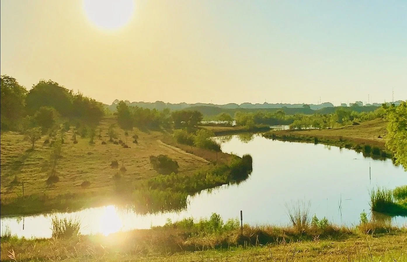
Overview
Willow Lake is a broad loop with open water and one of the most scenic walking paths in the Greenway. Named for the nearby bayou and road, the lake offers a mix of shoreline views, gentle elevation changes, and a distinctive wetland section that attracts water birds year-round. It’s a favorite for walkers, birdwatchers, and anyone looking to enjoy a longer, peaceful route through the park.
Highlights & Features
Loop trail circles the lake with a winding route and views of shorebirds
New Willow Waterhole sign at South Post Oak to introduce the park
Donor recognition sign honors contributions to restoration and improvements
Wetland shelf along the shoreline supports waterbirds and native plants
Grassy mounds on the east side offer elevated views across the lake
Concrete culverts connect to Heron and Prairie Lakes to balance water levels during storms
Location and Parking
📍 Surrounded by S. Willow Drive to the north, Post Oak Rd to the East, Gasmer Dr to the South and Ricecrest Street to the West. Visit Directions page
🅿️ Street parking is available along Ricecrest Street, between South Willow and Gasmer. Additional parking is available at the Clematis Lane North Lot from S. Willow and Clematis Lane South from Gasmer Dr with direct access to the Kinder Foundation Trail.
Spotlight Features

Wetland Shelf
This wetland along the east side of the lake supports native plants and attracts wading birds. It’s a visible example of habitat restoration and a favorite spot for birdwatchers and nature lovers.
Willow Waterhole Sign
This permanent sign near the trail recognizes donors whose contributions have shaped the entire Willow Waterhole Greenway. It reflects the community’s commitment to conservation, access, and public space.

Grassy Mound Overlook
These grassy mounds on the east side near Post Oak offer elevated views of the lake and surrounding trails. They’re a quiet spot for taking in the landscape or watching birds move across the water.
F. Prairie Lake
🌿Loop Trail: Cullen Foundation Trail (1.2 miles)
Overview
Prairie Lake is named for the native grasslands that stretch across this side of the Greenway. It borders the Prairie Management Area, a protected habitat for hundreds of plant species including the endangered Texas prairie dawn flower. The lake offers wide open views, frequent bird activity, and a strong sense of connection to Houston’s natural heritage.
Highlights & Features
Loop trail circles a broad open lake with prairie views
A native Prairie Preserve supports over 300 plant species
Home to the rare Texas prairie dawn flower, a federally protected species found only in this region
Grass trail segments and a low footbridge cross natural drainage area between lake and prairie
Borders the Post Oak Manor neighborhood, with easy access to nature and trails
Concrete culvert connects Prairie Lake to Westbury Lake to manage stormwater flow


Location and Parking
📍 Surrounded by S. Post Oak Rd to the West, Post Oak Manor neighborhood to the North and Gasmer Drive to the South.
🅿️ Street parking is available at the Gasmer Dr parking lot on the South side of the lake.
Spotlight Features

Texas Prairie Dawn Flower
This rare wildflower grows only in a few locations across Texas, including the edge of Prairie Lake. Its protected status highlights the importance of preserving native Gulf Coast prairie habitat.

Native Prairie Preserve
Along the lake’s northeast edge, this 15-acre protected area supports over 300 species of coastal prairie plants. Though access is limited, it serves as a vital habitat and conservation zone within the park.

Future Boardwalk Path
A grass trail now links the lake to the native prairie, crossing a natural drainage area. Plans are underway to convert it into a raised boardwalk that protects the landscape while offering better access and views.