Willow Waterhole Bayou

Willow Waterhole Bayou is a narrow 4-mile-long natural tributary of Brays Bayou. It flows through Houston’s Brays Oaks area—once oil tycoon Walter Fondren's ranch—and Westbury neighborhoods. In the 1940s, when the ranch land was being developed, portions of the original streambed were rerouted. Today the bayou emerges southeast of the intersection of W. Bellfort Blvd. and Fondren Rd. and eventually flows northeast from Braewick Dr. through the Westbury and Willow Meadows neighborhoods.
The bayou, Scout Lake, its weir (similar to a spillway), and the culvert connecting the lake to the basin complex can all be seen at the end of the 500-foot-long Bayou Trail, which begins at the left of The Gathering Place on S. Willow Dr.
In generations past, the bayou was known by people living nearby as “the ditch.” Even today it is generally a quiet stream of muddy water that stays within its banks, with a normal water level between 44.55 and 44.74 feet above sea level.
Willow Waterhole Bayou’s Path

Willow Waterhole Bayou emerges near the intersection of West Bellfort Ave. and Fondren Rd. and flows into Brays Bayou near the southwest corner of the I-610 Loop.
The bayou empties into Brays Bayou at the southwest corner of I-610 Loop.
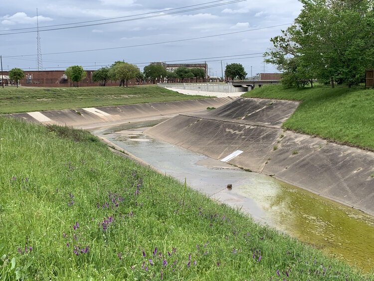
Willow Waterhole Bayou—Natural, Channelized, and Flooded

The Willow Waterhole “ditch” at Chimney Rock Rd. north of Gasmer St. is a muddy stream.

Parts of Willow Waterhole Bayou have been converted into a concrete channel.

A heavy rainfall can easily fill Willow Waterhole Bayou to the top of its banks.